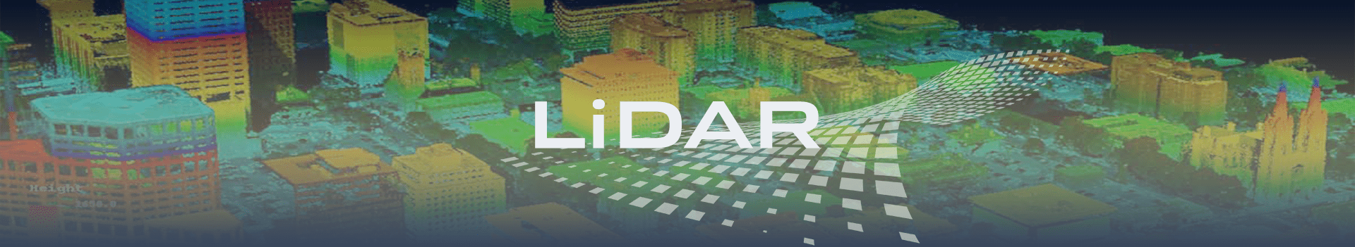
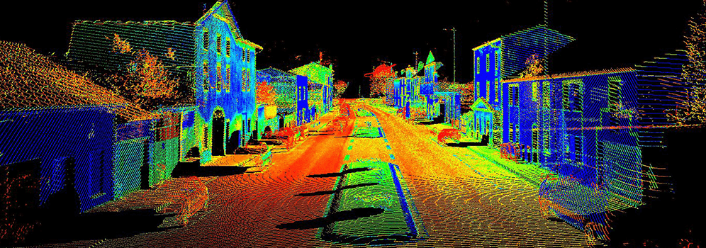
LiDAR
LiDAR is a surveying method that measures the distance to a target by illuminating that target with laser light. We at, InfoTech, combine LiDAR with GIS data and other survey information to generate complex geomorphic structure mapping products, advanced 3D models/earthwork profiles, rendering of structures, and many additional high-value mapping products. We offer post-processing of LiDAR point cloud data include Bare earth, utility, topographic and land use classification. We seamlessly integrate LiDAR data with other data sets, including Orthophoto imagery. We are providing LiDAR services to numerous customers globally for almost ten years now. InfoTech provides very cost-effectively and qualitative services which uplift customers from their competitors. We seamless integrate LiDAR data with other data sets, including orthophotos imagery.
LiDAR Services
LiDAR Mapping Services
Fast and cost-effective LiDAR map outsourcing tailored to your budget and needs!
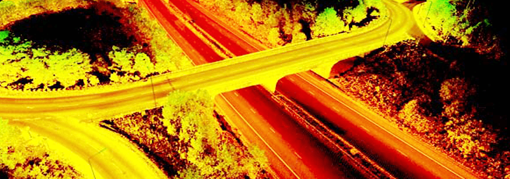
InfoTech Enterprises ranked among top LiDAR Mapping Companies in India for outsourcing services. Fast and cost-effective LiDAR map outsourcing tailored to your budget and needs. InfoTech outsourced mapping services include mapping from Light Detection and Ranging (LiDAR) survey data. We integrated both ground and aerial LiDAR data. Aerial data gathered uses laser reflection from the earth's surface captured by sensors in an aircraft. This technique allows the location of objects and precise elevation to be determined on different scales, making aerial LiDAR an appropriate approach for creating accurate topographical maps.
InfoTech outsourced mapping services include mapping from Light Detection and Ranging (LiDAR) survey data. Both ground and aerial LiDAR data can be integrated. Aerial data gathered in this way uses laser reflection from the earth's surface captured by sensors in an aircraft. This allows the precise elevation and location of objects to be determined on different scales, making aerial LiDAR an effective approach for creating accurate topographical maps.
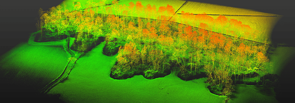
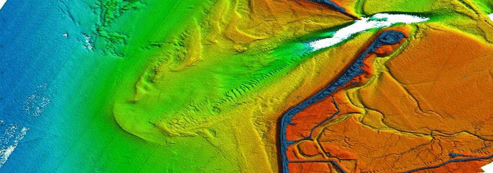
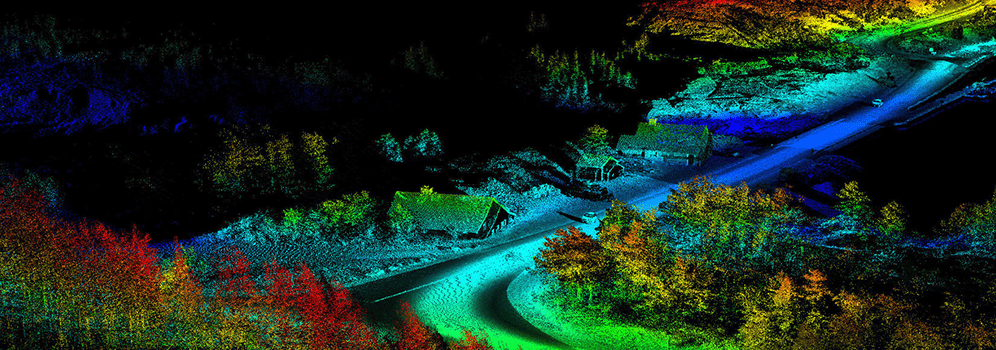
Bare Earth Classification
We extract bare earth using t-scan and across the section on a large scale, manually and automatically. We also processed on a small scale such as a view of 5m DTM surface after classification and from same bare earth, we extracted contours at 1m or 0.5m where the terrain is hilly or plains. We also expertise in working on a larger scale, presenting quality in bare earth and contours. We extract the vector line manually as per the client’s required accuracy (both horizontal & vertical) using T-scan intensity raster images or else provide orthophotos.
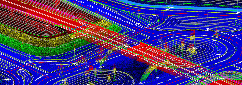
Utility Classification
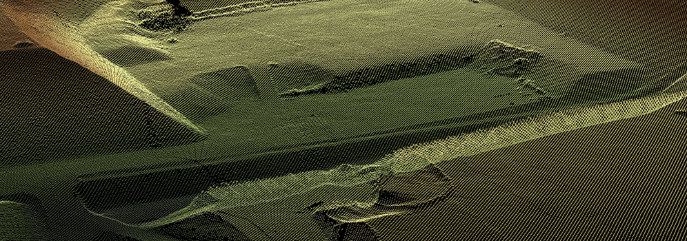
Utility classification is the technique for creating highly accurate, three-dimensional surveys of terrain, vegetation and electric utility infrastructure. The acquisition for modeling can be accomplished from the air or ground. This process is entirely based on Static terrestrial scanners and kinematic mobile mapping systems which collect the LiDAR data and image data from ground perspectives at densities ranging from 500 to 2000 points per square meter.
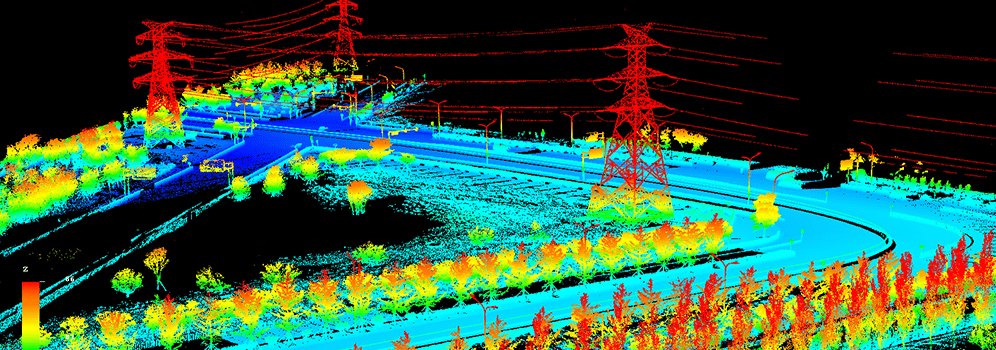
Benefits of utility classification:
- Reduce manpower & Equipment costing
- Enhanced quality of technology standards
- Timely execution
- Easy to maintain & Update
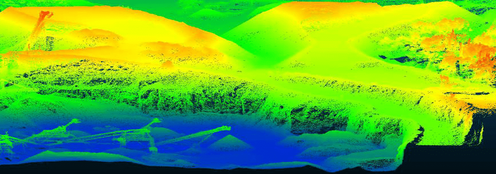
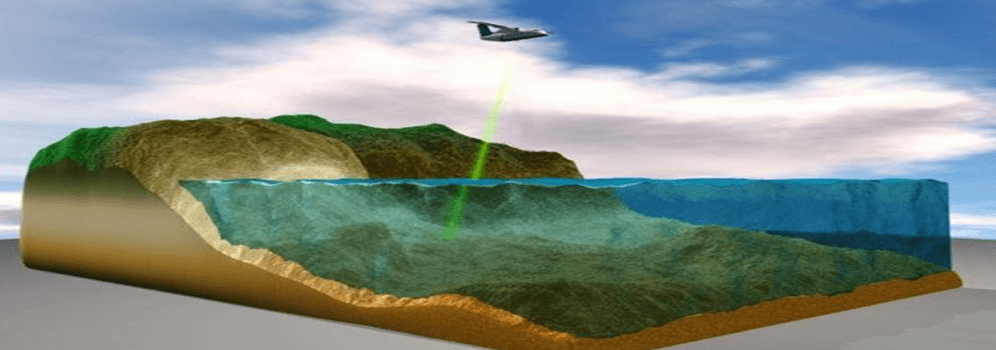
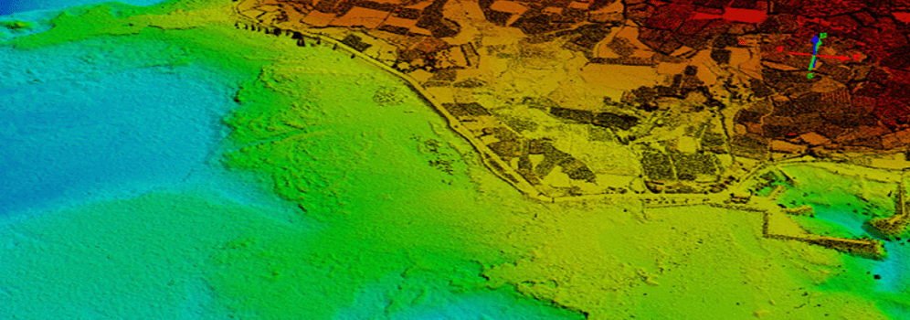
Bathymetry Classification
Bathymetry is the technique to capture geospatial data of the coastline and waters. It is an effective solution for a wide-area survey. Bathymetric LiDAR is the most effective and cost-efficient technology to capture both the land and seafloor simultaneously to provide a continuous, detailed 3D elevation model along the coastline. We at InfoTech provide highly accurate Bathymetry post-processing products and having dedicated LiDAR classification staffs.
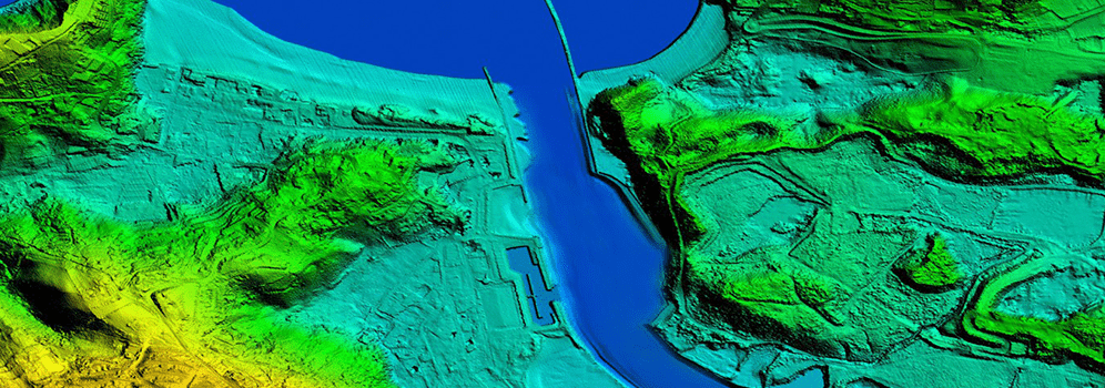
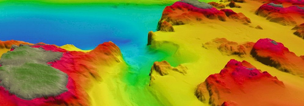
LiDAR classifications in bathymetry are:
- Ground-Ground
- Underwater Ground
- Underwater Vegetation
- Water Level
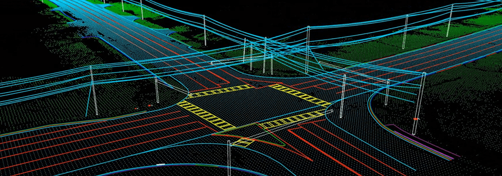
Mobile Mapping
Mobile mapping is the process of collecting geospatial data from a mobile vehicle, fitted with a range of photographic, radar, laser, LiDAR or any remote sensing system.
Benefits of mobile mapping system:
- Easy to navigate.
- Boost data accuracy.
- Speed.
- Efficiency.
- Detail mapping of inaccessible areas.